
Home / Products / Meteorology / WindCube®
WindCube®
Overview
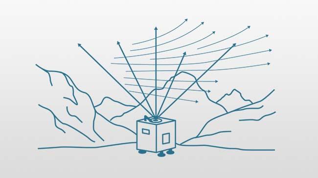
WindCube® provides highly accurate, reliable wind measurements up to 300m, with 20 simultaneous heights measured per second. It enhances many applications, reducing uncertainty and improving decision-making across a wide range of use cases.
WindCube is the most trusted wind lidar available. It meets or exceeds the relevant standards from leading regulatory and certification bodies, and every WindCube unit is rigorously tested using current best practices to ensure uniformity and accuracy.
WindCube is backed by the best warranty and service options for each industry it serves. Vaisala is uniquely positioned to offer global, fast support wherever your projects are located, and WindCube is known the world over for its reliability and ease of use no matter the application or environment.
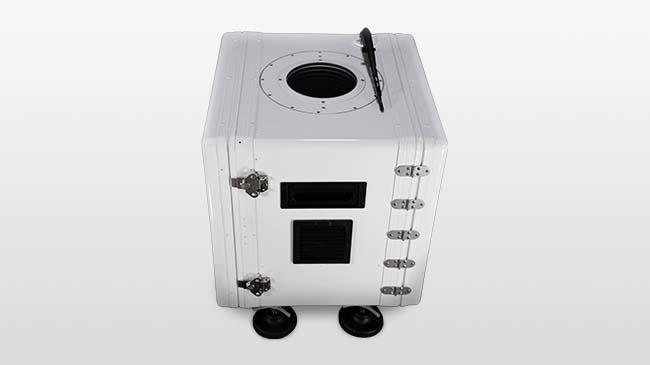
WindCube lidar units are renowned for their portability, simple deployments, and fast time-to-value. They often avoid regulatory and permitting hassles that affect legacy technologies, and each lidar unit can be repurposed easily for future measurement campaigns.
An organization, no matter how well designed, is only as good as the people who live and work in it.